|
GC6T31J
 Herman Lake Metamorphic Rocks
Type: Earth | Size: Other  | Difficulty:
  | Terrain:
  By: msstrong @ | Hide Date: 09/15/2016 | Status: Available Country: United States | State: Colorado Coordinates: N39° 43.387 W105° 53.604 | Last updated: 08/30/2019 | Fav points: 0 


")
This cache is on the Herman's Gulch trail. To get to the big parking lot at the trailhead, take Exit 218 off of I-70, just before you get to the Route 6 exit. The hike to Herman Lake is 3.2 miles (7.4 miles round trip) with 1800' of elevation gain. This hike can be done year around but be very careful in the winter, and read the warning signs that are posted at the trail head.
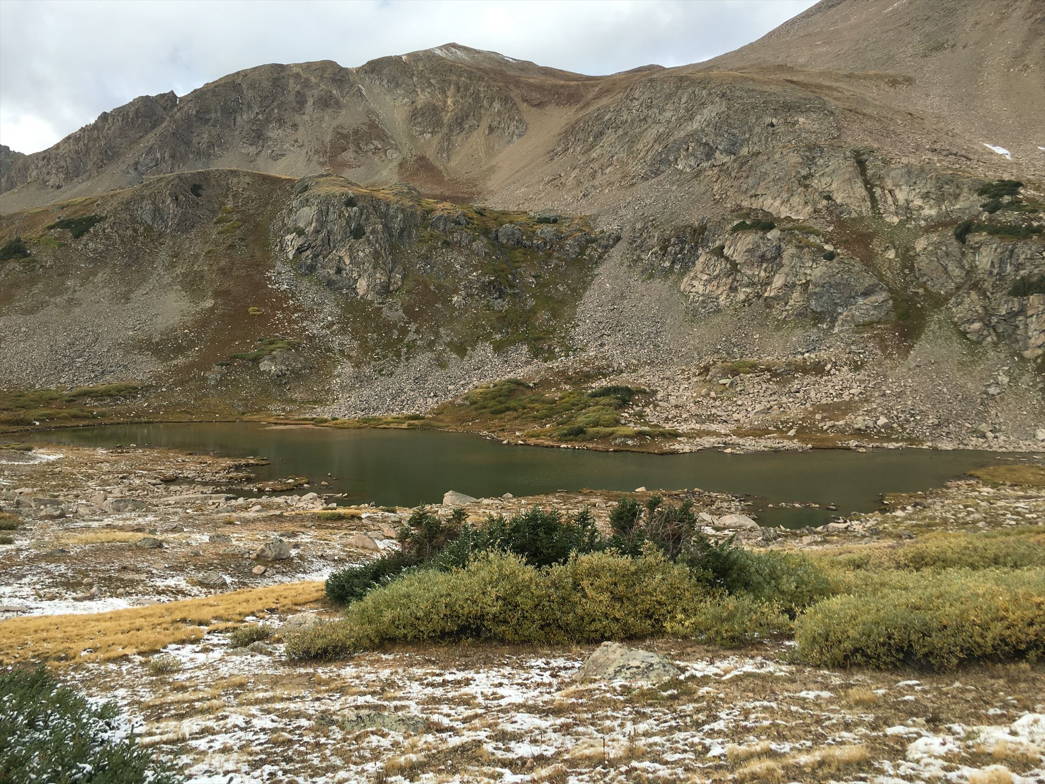 Have you ever been on a hike somewhere exploring nature and see something different in the local surroundings and wonder how it was formed and how it arrived in its current location, and why's it so different from everything else around? Well that's what happened to me as we hiked to this basin on Herman's Gulch Trail, as you will see at the given coordinates. What do you see? My question was how did these large objects that are very different than the surrounding mountains and other rocks and boulders scattered through out the area get here? So I went home and looked it up and here is what I found. These 2 large boulders are called "Metamorphic rocks" Metamorphic rock is formed underground through a process that changes a rock's molecular structure due to pressure, heat and chemical reactions. A metamorphic rock forms from a parent rock called a protolith. A protolith is the original, unmetamorphosed rock from which a given metamorphic rock is formed (proto-: first; lithos: rock; both Greek). For example, the protolith of a slate is a shale or mudstone Depending on conditions, a protolith can transform into any metamorphic rock. Because protoliths are capable of undergoing vast changes, identifying them is sometimes difficult for geologists. Direct contact with hot magma is called contact metamorphism. When a sedimentary or igneous rock meets magma, fluids and vapors are created in the existing rock, changing the rock's chemical composition. Regional metamorphism occurs due to the extreme pressure built up from the process of the Earth thrusting upward to form mountains. This intense pressure causes a change in temperature, which can chemically alter the contents of the rock. Dynamic metamorphism also occurs due to intense pressure and is linked to sudden geographic upheavals. Under extreme pressures, such as between two colliding tectonic plates, the minerals of a metamorphic rock group together and align to form foliation, which appears as stripes in the rock. One example of a heavily foliated rock is gneiss. (see photo below) Alternatively, highly heated areas, such as near magma chambers, produce vastly different metamorphic rocks. One example is hornfels. (See photo below) Over millions of years the surrounding mountain range was formed and covered with glacial ice, then as the glaciers moved and receded they tore these metamorphic rocks from the surrounding rocks leaving them exposed. FOLIATED metamorphic rocks such as gneiss, phyllite, schist, and slate and HAVE A LAYERED OR BANDED APPEARANCE. Gneiss 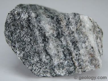 NON-FOLIATED metamorphic rocks such as hornfels, marble, quartzite, and novaculite DO NOT HAVE A LAYERED OR BANDED APPEARANCE. Hornfels 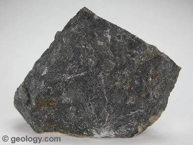 To get credit for this EarthCache please inspect the two rocks at this location and answer these 2 questions: 1. Are they Foliated or NON Foliated rocks? 2. What is the most predominate layer in either rock, what's it's color, and how thick is it? Photos of the beautiful location are very welcome, but please don't show to much of these 2 special rocks.
Add cache to watch list Log your visit Picture Gallery
GC1GAAM Colorado Spirit Quest #131 - Fraser Ceme (24.88 kms N) GC2F7WF Boston Mine (40.75 kms SW) GC902K1 rainbow lakes rd # 4 (42.08 kms NE) GC8F28 Frazer Meadow Cache (42.29 kms E) GC7CCHT Rockland Cemetery (53.08 kms E) |
Driving Directions
6 Logs:
|